npsot_bluebonnet_full_color

White Milkwort

Polygala alba

Other common name(s):

Family:

Polygalaceae (Milkwort Family)

Plant Ecoregion Distribution Map

Central Great Plains, Chihuahuan Deserts, Cross Timbers, East Central Texas Plains, Edwards Plateau, Gulf Coast Prairies and Marshes, High Plains, Southern Texas Plains, Southwestern Tablelands, Texas Blackland Prairies
Broken Red Plains, Limestone Plains
Chihuahuan Desert Grasslands, Chihuahuan Montane Woodlands, Low Mountains and Bajadas, Stockton Plateau
Carbonate Cross Timbers, Eastern Cross Timbers, Grand Prairie, Limestone Cut Plain, Western Cross Timbers
Southern Post Oak Savanna
Balcones Canyonlands, Edwards Plateau Woodland, Llano Uplift, Semiarid Edwards Plateau
Southern Subhumid Gulf Coastal Prairies
Arid Llano Estacado, Canadian/Cimarron High Plains, Llano Estacado, Rolling Sand Plains
Rio Grande Floodplain and Terraces, Texas-Tamaulipan Thornscrub
Canadian/Cimarron Breaks, Caprock Canyons Badlands Breaks, Flat Tablelands and Valleys, Semiarid Canadian Breaks
Floodplains and Low Terraces1, Northern Blackland Prairie, Southern Blackland Prairie

Plant Characteristics

Growth Form

Herbaceous

Height

0.5
to
1
ft.

Spread

1
to
2
ft.

Leaf Retention

Deciduous

Lifespan

Perennial

Habitat and Care Requirements

Soil Type(s)

Sand, Loam, Clay, Calcareous

Light Requirement

Sun, Part Shade

Water Requirement

Low

Native Habitat

Grassland

Bloom and Attraction

Bloom Color

White

Bloom Season

Spring, Summer, Fall

Seasonal Interest

Nectar, Pollen

Wildlife Benefit

Nectar Insects, Bees

Maintenance

Little maintenance required. Drought tolerant due to a large, tuberous root. Grows in a variety of soils. Works well in perennial gardens, rock gardens and shortgrass meadows. High deer resistance. Propagation: seed.

Comments

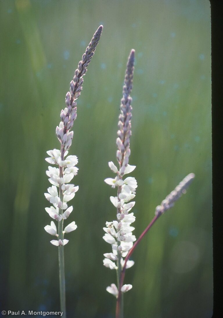
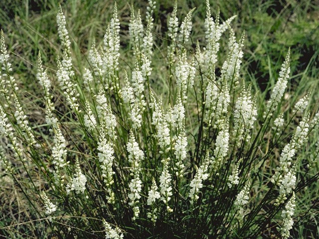
Blooms April-November. Produces many slender, mostly unbranched stems, each topped with a spike of small white flowers with yellow-green centers. Leaves are narrow, but a little broader at the base. The fruit is a capsule.
Previous Scientific Name(s): Polygala alba var. suspecta

References

1) Griffith, Bryce, Omernick & Rodgers (2007). Ecoregions of Texas. 2) Wasowski and Wasowski, Native Texas Plants Landscaping Region by Region, 1991, pg. 204. 3) https://www.wildflower.org/plants/result.php?id_plant=POAL4. 4) https://portal.torcherbaria.org/portal/taxa/index.php?taxon=Polygala+alba&formsubmit=Search+Terms. 5) http://bonap.net/TDC/Image/Map?taxonType=Species&taxonId=19538&locationType=County&mapType=Normal. 6) https://www.itis.gov/servlet/SingleRpt/SingleRpt?search_topic=TSN&search_value=29323#null, 7) https://prairiepollination.ca/plante-plant/polygale_seneca-seneca_snakeroot/
Receive the latest native plant news

Subscribe To Our News

Subscribe to emails from the Native Plant Society of Texas.

Receive emails when new posts are added 4-6 times per month, or receive an email once a month.

Or join us on social media

About the Region

New Braunfels, the location of our Fall 2024 Symposium, straddles both the Edwards Plateau Ecoregion and the Blackland Prairie ecoregion. Interstate 35 divides the city of New Braunfels; its path through the city closely parallels the boundary of these two ecoregions, with the Edwards Plateau on the west side and the Blackland Prairies region to the east. The Edwards Plateau area is also called the Hill Country; however, this general term covers a much larger area extending farther north. Spring-fed creeks are found throughout the region; deep limestone canyons, rivers, and lakes (reservoirs) are common. Ashe juniper is perhaps the most common woody species found throughout the region. Additional woody species include various species of oak, with live oak (Quercus fusiformis) being the most common. Sycamores (Platanus occidentalis) and bald cypress (Taxodium distichum) border waterways. This area is well known for its spring wildflower displays, though they may be viewed in spring, late summer, and fall, as well. According to Texas Parks and Wildlife, average annual rainfall in the Edwards Plateau ranges from 15 to 34 inches.

The Blackland Prairie extends from the Red River south to San Antonio, bordered on the west by the Edwards Plateau and the Cross Timbers, and on the east by the Post Oak Savannah. Annual rainfall averages 30 to 40 inches, with higher averages to the east. This region is dominated by prairie species. The most common grass species include little bluestem (Schizachyrium scoparium) and Indian grass (Sorghastrum nutans) in the uplands and switchgrass (Panicum virgatum) in the riparian areas and drainages. Common herbaceous flowering plants include salvias, penstemons, and silphiums. This area has suffered greatly from overgrazing and agricultural use. Few intact areas remain, though many of the plants can be found along county roadsides throughout the region.

Our four host chapters (New Braunfels, Lindheimer, Guadalupe, and the Hill Country chapters) are located in one or both of the ecoregions above. However, the eastern portion of Guadalupe County also falls within the Post Oak Savanna ecoregion. Annual rainfall averages 35 to 45 inches, with higher averages to the east. A wide variety of hardwood trees are found, including several species of oaks, elms, and in the Bastrop area, loblolly pine (Pinus taeda). Grasses and forbs dominate in the open savannas, with most common grass being little bluestem. Ranching, agriculture, and fire suppression have allowed woody species to encroach on the once-open savannas.

Source: Wildflowers of Texas by Michael Eason