

 In 2016, through a major joint working arrangement between the US Fish and Wildlife Service, the Texas Department of Transportation and the Native Plant Society of Texas, the support and creation of four Monarch Pollinator Gardens located at four Safety Rest Areas along busy I-35, were created.
 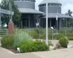 This effort was caused by the national recognition that both pollinator and bird species have had a drastic decline since the 1970’s and in particular, the number of the uniquely migrating Monarch Butterflies were in especially precipitous decline.
The Monarchs are amazingly unique. They will spend their winters in Mexico then beginning in April will take flight and begin their long spring migration to the northern United States and Canada. In fall, they will return to Mexico and begin the great cycle all over again.
 Their migratory path, both in spring and fall, funnel through Texas and more specifically often through the central Texas corridor along busy I-35.
In the spring, Monarch Butterflies are in dire need of milkweed plants on which they lay their eggs. In the fall they need nectar plants on which they fuel themselves for the long journey to their winter homes.
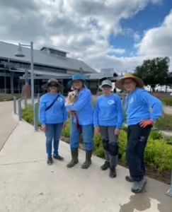 Through the hard work and dedication of countless volunteers over the last 8 years, these wonderful migration gardens have provided the necessary milkweed and nectar plants in attractive migration gardens that are helping to keep the monarch population alive.
 During their monthly work sessions, volunteers regularly hold Bring Back the Monarch educational sessions which explain the value and role of native Texas plants to visitors of the Safety Rest Areas.
Wonderfully designed NPSOT created coloring books and crayons are given out to the kids who, as they travel with their families north and south along busy I-35, The Monarch Way, understand that they also share the highway and their travels, not just with their families, but with the wonderful Monarch Butterfly!
 This NPSOT project provides a wonderful opportunity for those folks who like to get their hands in the dirt as well as those who like to gab about the benefits of using Texas Native Plants. These gardens are interesting and busy with a constant stream of visitors who appreciate our efforts and provide many opportunities to interact, to educate and to make a difference.
Please considering Volunteering for this opportunity to apply your interest, skills and knowledge, in a meaningful way.
Contact i-35.mwsra@npsot.org for more information.
